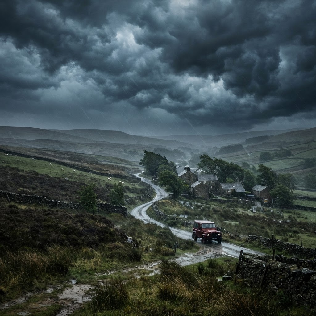
MET Office Issues Yellow Wind Warning as 70mph Gales Batter Western Scotland
The Met Office has issued a yellow severe weather warning for wind covering northwest Scotland on Wednesday, 14 October 2026. Gusts reaching up to 70 mph are expected to cause transport disruption, ferry delays, and possible power cuts. The warning remains active until 19:00 UTC+1 this evening.
Latest Stories
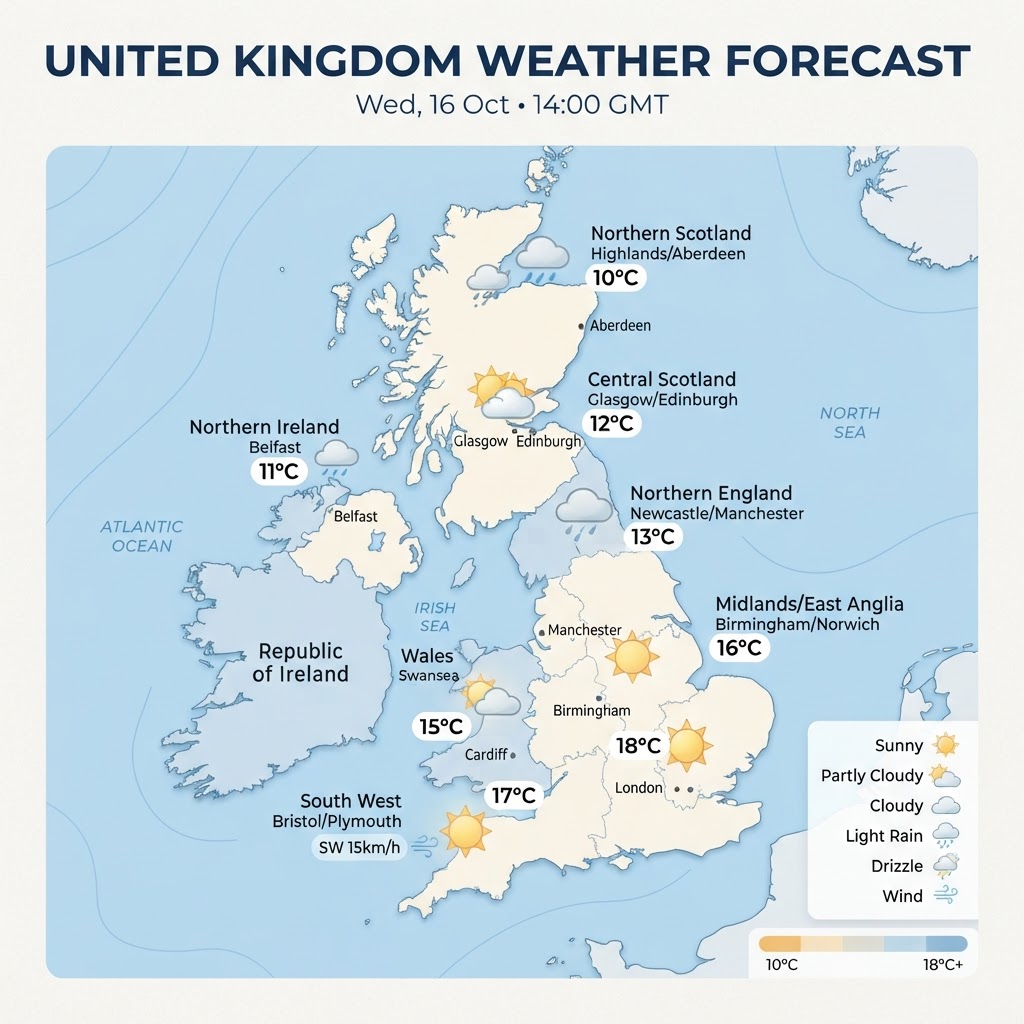
UK Weather Forecast: Mild and Sunny in the Southeast as Rain Band Pushes Across Central Areas – Thursday, 15 October 2026
An unsettled front continues its slow track southeastwards across northern England and Wales today, bringing outbreaks of patchy rain. In contrast, southeastern England will enjoy an unseasonably warm and bright autumn afternoon with highs reaching up to 20°C, while Scotland and Northern Ireland turn fresher with scattered blustery showers.
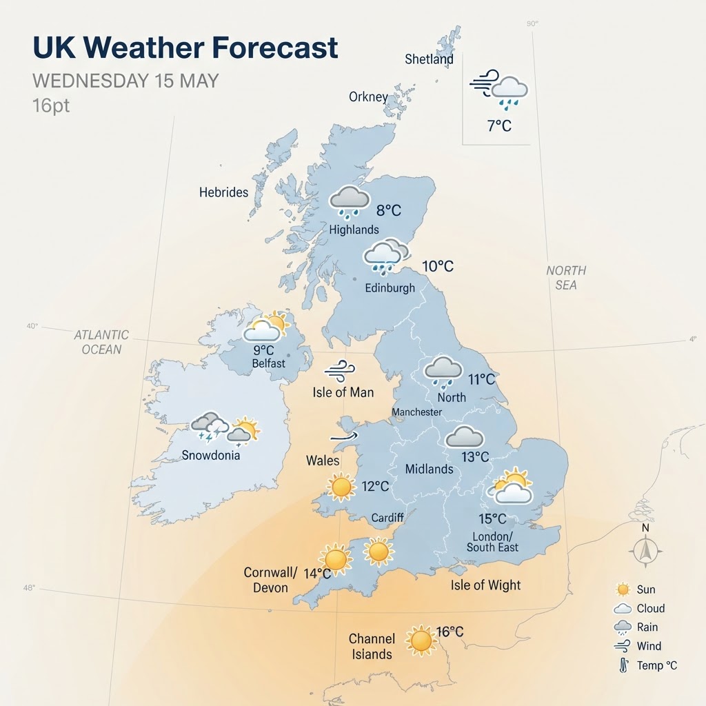
UK Weather Forecast: Mild and Largely Dry Today Ahead of Approaching Atlantic Front – Wednesday, 14 October 2026
Wednesday brings a settled, largely dry day across the UK with pleasant sunny spells and unseasonably mild highs of up to 19°C in the south. Cloud will thicken from the west through the afternoon as breezes freshen ahead of incoming Atlantic rain systems. No severe weather warnings are currently in force, though unsettled conditions are set to arrive over the next 48 hours.
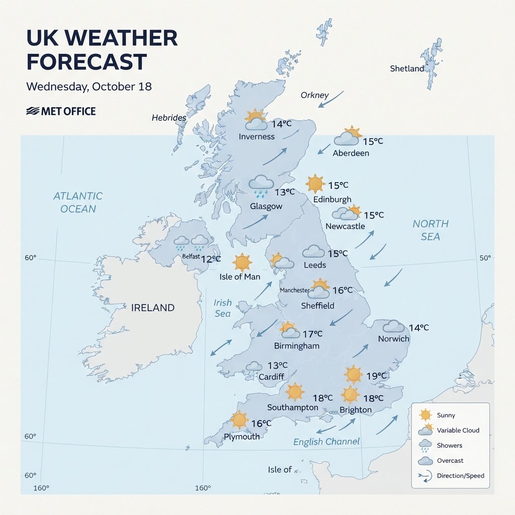
UK Weather Forecast: Morning Rain Clears to Mild Bright Spells Before Fresh Showers Move In – Tuesday, 13 October 2026
A frontal band of blustery morning rain will sweep southeast across England and Wales today, clearing into a remarkably mild and brighter afternoon with highs peaking near 20°C to 21°C. Meanwhile, northern and western areas, particularly Scotland and Northern Ireland, will experience cooler conditions with blustery showers feeding in behind the clearance. The unsettled, changeable pattern looks set to continue over the next 48 hours as secondary fronts approach from the Atlantic.
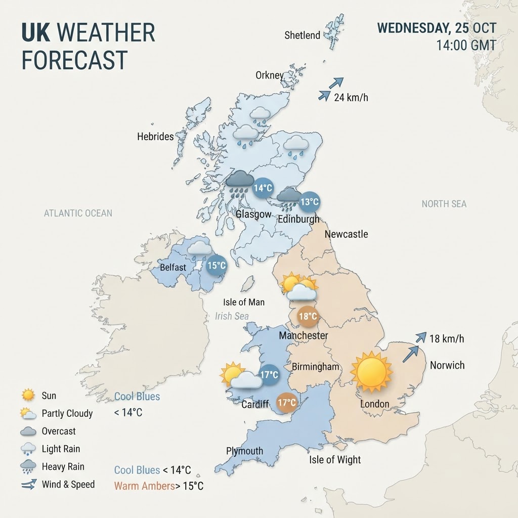
UK Weather Forecast: Mild, Breezy Conditions Across Britain With Heavy Rain Arriving in Northwest – Monday, 12 October 2026
Monday brings an unseasonably mild and breezy autumn day across most of the UK, with temperatures reaching up to 17°C in parts of England. However, cloud will gradually thicken from the west, leading to heavier outbreaks of rain sweeping into Northern Ireland and northwestern Scotland later in the day.
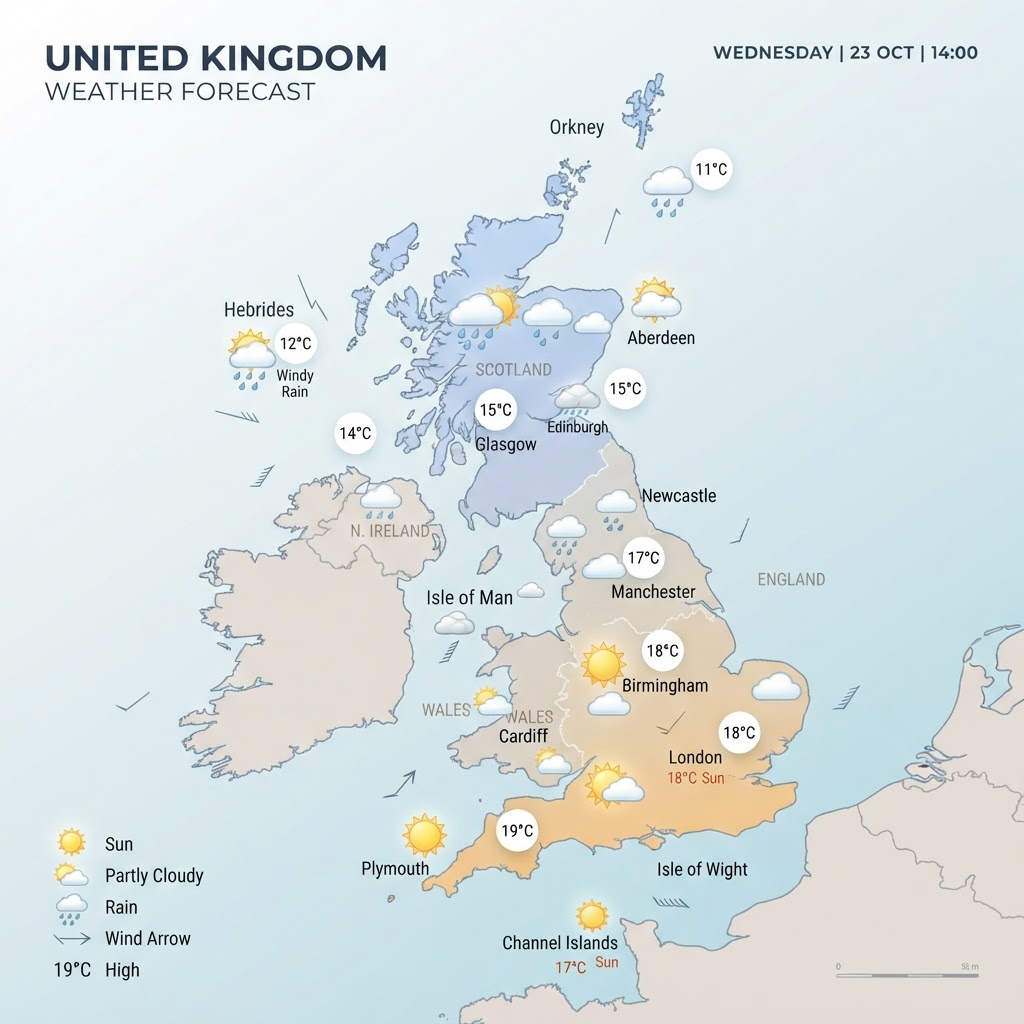
UK Weather Forecast: Mild and Breezy Day with Northwest Rain Moving In – Sunday, 11 October 2026
Sunday brings a largely dry and overcast day for central and eastern areas, while breezy conditions and heavier rain develop across the northwest. Afternoon temperatures remain mild for mid-October, reaching 15°C to 17°C across southern and central Britain before an unsettled front pushes southeast overnight.

How to Prepare for Cold Weather in the UK: A Complete Winter Safety Guide
Winter in the UK can bring a wide range of weather conditions, from chilly frosty mornings to heavy snowfall, ice and freezing temperatures. While some people enjoy the colder months, winter weather can create challenges for travel, homes, health and daily life. Being prepared before cold weather arrives can help keep you and your family safe, comfortable and ready for whatever winter delivers. This guide explains some practical steps you can take to prepare for cold conditions and minimise potential disruption during the winter months. Understanding the Risks of Cold Weather Cold weather can affect more than just comfort levels. Freezing temperatures can lead to icy roads and pavements, frozen pipes, power interruptions and increased health risks, particularly for older people and those with existing medical conditions. Even temperatures that are only slightly below freezing can create dangerous conditions. Ice can form overnight on untreated surfaces, making journeys hazardous, while prolonged cold spells can put additional strain on heating systems. Paying attention to weather forecasts and warnings is one of the simplest ways to stay informed about any potential risk. Preparing Your Home One of the most important parts of winter preparation is ensuring your home is ready for cold weather. Check that your boiler and heating system are working correctly before winter begins. If any issues arise, it is usually easier to arrange repairs before demand for heating engineers increases during severe cold spells. It is also worth checking insulation around doors, windows and loft spaces. Good insulation helps retain heat, lowers energy bills and keeps indoor temperatures more comfortable. Pipes located in lofts, garages or outside walls are particularly vulnerable to freezing temperatures. Pipe insulation is relatively inexpensive and can help prevent costly damage from burst pipes. Having a secondary source of warmth, such as extra blankets or sleeping bags, can also provide peace of mind if heating systems fail during particularly cold weather. Creating an Emergency Kit Although most winter weather events in the UK are short-lived, it is sensible to prepare for temporary disruption. An emergency winter kit could include: Torches and spare batteries A battery-powered radio Mobile phone power banks Bottled water Long-life food supplies Essential medications Blankets and warm clothing Basic first aid supplies These items can be useful if travel becomes difficult or if local services are temporarily affected by severe weather conditions. Staying Warm Outdoors Dressing appropriately is one of the best ways to protect yourself during cold weather. The key is to wear multiple layers rather than one thick layer. Several layers trap warm air more effectively and allow adjustments if temperatures change throughout the day. A typical winter outfit should include: A thermal or moisture-wicking base layer A warm middle layer such as fleece or wool A waterproof and windproof outer layer Hat, gloves and scarf Waterproof footwear with good grip A significant amount of body heat can be lost through the head, hands and feet, so protecting these areas is especially important when spending extended periods outside. Looking After Your Health Cold weather can place extra strain on the body. It can worsen existing health conditions and increase the risk of illnesses such as flu, colds and respiratory infections. Maintaining a healthy indoor temperature is important, especially for elderly people and vulnerable family members. Regular hot meals and warm drinks can help maintain body temperature and support overall wellbeing. It is also important to remain active where possible. Moving around helps improve circulation and can make it easier to stay warm during colder periods. Checking on neighbours, family members and friends who may need additional support during severe weather is another simple but valuable step. Safe Winter Driving Driving conditions can change rapidly during winter, particularly during frosty mornings or snowfall. Before setting off, clear all snow and ice from windows, mirrors and lights. Give yourself extra time to travel and increase stopping distances on wet, icy or snowy roads. It is also wise to keep a winter emergency kit in your vehicle containing: Ice scraper and de-icer Blanket Torch Mobile phone charger Snacks and drinking water High-visibility clothing Small shovel if snow is forecast Keeping your fuel tank reasonably full can also help if traffic delays occur during severe weather. Preparing for Snowfall Snowfall can be enjoyable but occasionally causes significant disruption. If heavy snow is forecast, consider completing any essential shopping beforehand. This helps avoid unnecessary journeys in hazardous conditions. Homeowners may wish to keep supplies such as rock salt or grit for paths and driveways. Clearing frequently used walkways can reduce the risk of slips and falls. When snow accumulates on roofs or structures, avoid attempting dangerous clearances yourself. Seek professional advice if there are concerns about excessive weight or damage. Protecting Pets and Animals Pets can be affected by cold weather just as humans can. Ensure animals have access to shelter, fresh water and warm bedding. Outdoor pets may require additional protection during freezing temperatures. After walks, check dogs' paws for ice, road salt or grit, which can cause irritation and discomfort. Wildlife can also benefit from additional food and unfrozen water sources during prolonged cold spells. Monitoring Weather Forecasts Weather conditions can change quickly, especially during winter. Regularly checking reliable weather forecasts can help you stay ahead of approaching cold spells, frost, ice and snow. Weather warnings are designed to provide advance notice of potentially disruptive conditions and allow people to take action before impacts occur. Understanding the difference between frost, ice, snow and freezing rain can also help you assess risks more accurately when planning travel or outdoor activities. Final Thoughts Cold weather is a normal part of winter in the UK, but preparation can make a significant difference when temperatures fall. Taking simple steps now, such as checking your heating system, creating an emergency kit, planning for winter travel and staying informed through weather forecasts, can help keep you safe and minimise disruption. While severe cold spells may only occur occasionally, being prepared means you can face winter with confidence. Whether the season brings a few frosty mornings or significant snowfall, planning ahead ensures you, your family and your home are ready for whatever the weather has in store.
Storm Warnings
See all
Heightened Risk of Thunderstorms
A vigorous spell of thunderstorms is expected this evening, with the Met Office issuing a yellow warning highlighting the risk of intense downpours, lightning, hail, and localised flooding across parts of the UK. The warning window typically covers late afternoon into the evening, and although not every location will see severe weather, those that do may experience rapidly changing and disruptive conditions. ⚡ Key Features of This Evening’s Thunderstorm Risk Thunderstorms developing later today are expected to be slow‑moving, meaning any area caught under one could see high rainfall totals in a short period. The Met Office notes that some storms may produce 15–25mm of rain in 1–2 hours, with isolated spots potentially reaching 40mm in 3–6 hours. This intensity raises the likelihood of flash flooding, especially in built‑up or low‑lying areas. Alongside heavy rain, storms may bring: • Frequent lightning, posing a risk to outdoor events and exposed locations • Gusty winds capable of causing minor damage • Small hail, particularly in stronger cells • Sudden reductions in visibility due to torrential rain These hazards can combine to create challenging conditions for travel, especially during the evening peak. 🌧️ Areas Most at Risk While thunderstorms may develop widely, the most intense activity is expected across parts of Scotland, Northern Ireland, and northern England, where the Met Office highlights the potential for thundery downpours, lightning, and hail. England and Wales may also see scattered heavy showers, though the strongest storms are more likely further north. In Scotland, the warning area has recently been expanded to cover Aberdeen, Aberdeenshire, the Highlands, and Angus, reflecting increasing confidence in widespread heavy showers and thunderstorms. 🚨 Expected Impacts This Evening The combination of heavy rain and lightning could lead to: • Localised flash flooding of roads, homes, and businesses • Spray and standing water, causing difficult driving conditions • Delays to bus and train services • Short‑term power outages due to lightning strikes • Disruption to outdoor events The Met Office advises staying alert to rapidly changing conditions and checking travel updates before setting out. Emergency agencies, including SEPA in Scotland, are urging residents to take sensible precautions such as preparing flood plans, moving valuables to higher ground, and staying clear of fast‑flowing water. 🛡️ Staying Safe During Thunderstorms If you hear thunder while outdoors, seek shelter immediately in a fully enclosed building or vehicle. Avoid trees, metal structures, and exposed high ground. Indoors, unplug sensitive electrical equipment and keep away from windows. Those in flood‑prone areas should remain vigilant and be ready to act quickly if water levels rise.

Forecasts
See allUK Weather Forecast: Mild and Sunny in the Southeast as Rain Band Pushes Across Central Areas – Thursday, 15 October 2026
An unsettled front continues its slow track southeastwards across northern England and Wales today, bringing outbreaks of patchy rain. In contrast, southeastern England will enjoy an unseasonably warm and bright autumn afternoon with highs reaching up to 20°C, while Scotland and Northern Ireland turn fresher with scattered blustery showers.
UK Weather Forecast: Mild and Largely Dry Today Ahead of Approaching Atlantic Front – Wednesday, 14 October 2026
14 Oct 2026UK Weather Forecast: Morning Rain Clears to Mild Bright Spells Before Fresh Showers Move In – Tuesday, 13 October 2026
13 Oct 2026UK Weather Forecast: Mild, Breezy Conditions Across Britain With Heavy Rain Arriving in Northwest – Monday, 12 October 2026
12 Oct 2026Be Prepared
See allHow to Prepare for Cold Weather in the UK: A Complete Winter Safety Guide
Winter in the UK can bring a wide range of weather conditions, from chilly frosty mornings to heavy snowfall, ice and freezing temperatures. While some people enjoy the colder months, winter weather can create challenges for travel, homes, health and daily life. Being prepared before cold weather arrives can help keep you and your family safe, comfortable and ready for whatever winter delivers. This guide explains some practical steps you can take to prepare for cold conditions and minimise potential disruption during the winter months. Understanding the Risks of Cold Weather Cold weather can affect more than just comfort levels. Freezing temperatures can lead to icy roads and pavements, frozen pipes, power interruptions and increased health risks, particularly for older people and those with existing medical conditions. Even temperatures that are only slightly below freezing can create dangerous conditions. Ice can form overnight on untreated surfaces, making journeys hazardous, while prolonged cold spells can put additional strain on heating systems. Paying attention to weather forecasts and warnings is one of the simplest ways to stay informed about any potential risk. Preparing Your Home One of the most important parts of winter preparation is ensuring your home is ready for cold weather. Check that your boiler and heating system are working correctly before winter begins. If any issues arise, it is usually easier to arrange repairs before demand for heating engineers increases during severe cold spells. It is also worth checking insulation around doors, windows and loft spaces. Good insulation helps retain heat, lowers energy bills and keeps indoor temperatures more comfortable. Pipes located in lofts, garages or outside walls are particularly vulnerable to freezing temperatures. Pipe insulation is relatively inexpensive and can help prevent costly damage from burst pipes. Having a secondary source of warmth, such as extra blankets or sleeping bags, can also provide peace of mind if heating systems fail during particularly cold weather. Creating an Emergency Kit Although most winter weather events in the UK are short-lived, it is sensible to prepare for temporary disruption. An emergency winter kit could include: Torches and spare batteries A battery-powered radio Mobile phone power banks Bottled water Long-life food supplies Essential medications Blankets and warm clothing Basic first aid supplies These items can be useful if travel becomes difficult or if local services are temporarily affected by severe weather conditions. Staying Warm Outdoors Dressing appropriately is one of the best ways to protect yourself during cold weather. The key is to wear multiple layers rather than one thick layer. Several layers trap warm air more effectively and allow adjustments if temperatures change throughout the day. A typical winter outfit should include: A thermal or moisture-wicking base layer A warm middle layer such as fleece or wool A waterproof and windproof outer layer Hat, gloves and scarf Waterproof footwear with good grip A significant amount of body heat can be lost through the head, hands and feet, so protecting these areas is especially important when spending extended periods outside. Looking After Your Health Cold weather can place extra strain on the body. It can worsen existing health conditions and increase the risk of illnesses such as flu, colds and respiratory infections. Maintaining a healthy indoor temperature is important, especially for elderly people and vulnerable family members. Regular hot meals and warm drinks can help maintain body temperature and support overall wellbeing. It is also important to remain active where possible. Moving around helps improve circulation and can make it easier to stay warm during colder periods. Checking on neighbours, family members and friends who may need additional support during severe weather is another simple but valuable step. Safe Winter Driving Driving conditions can change rapidly during winter, particularly during frosty mornings or snowfall. Before setting off, clear all snow and ice from windows, mirrors and lights. Give yourself extra time to travel and increase stopping distances on wet, icy or snowy roads. It is also wise to keep a winter emergency kit in your vehicle containing: Ice scraper and de-icer Blanket Torch Mobile phone charger Snacks and drinking water High-visibility clothing Small shovel if snow is forecast Keeping your fuel tank reasonably full can also help if traffic delays occur during severe weather. Preparing for Snowfall Snowfall can be enjoyable but occasionally causes significant disruption. If heavy snow is forecast, consider completing any essential shopping beforehand. This helps avoid unnecessary journeys in hazardous conditions. Homeowners may wish to keep supplies such as rock salt or grit for paths and driveways. Clearing frequently used walkways can reduce the risk of slips and falls. When snow accumulates on roofs or structures, avoid attempting dangerous clearances yourself. Seek professional advice if there are concerns about excessive weight or damage. Protecting Pets and Animals Pets can be affected by cold weather just as humans can. Ensure animals have access to shelter, fresh water and warm bedding. Outdoor pets may require additional protection during freezing temperatures. After walks, check dogs' paws for ice, road salt or grit, which can cause irritation and discomfort. Wildlife can also benefit from additional food and unfrozen water sources during prolonged cold spells. Monitoring Weather Forecasts Weather conditions can change quickly, especially during winter. Regularly checking reliable weather forecasts can help you stay ahead of approaching cold spells, frost, ice and snow. Weather warnings are designed to provide advance notice of potentially disruptive conditions and allow people to take action before impacts occur. Understanding the difference between frost, ice, snow and freezing rain can also help you assess risks more accurately when planning travel or outdoor activities. Final Thoughts Cold weather is a normal part of winter in the UK, but preparation can make a significant difference when temperatures fall. Taking simple steps now, such as checking your heating system, creating an emergency kit, planning for winter travel and staying informed through weather forecasts, can help keep you safe and minimise disruption. While severe cold spells may only occur occasionally, being prepared means you can face winter with confidence. Whether the season brings a few frosty mornings or significant snowfall, planning ahead ensures you, your family and your home are ready for whatever the weather has in store.


Flooding
See all
Flooding in Nepal
🌍 The Setting: A Vulnerable Himalayan Landscape Nepal’s northern districts sit within some of the world’s steepest and most fragile terrain. Valleys such as Nuwakot, Rasuwa, and the Bhote Koshi River corridor are vital travel and economic lifelines, yet they are extremely vulnerable to sudden hydrological disasters. When a glacial system destabilises, the narrow valleys act as funnels, amplifying the destructive force of water, mud, and rock. On the morning of the disaster, skies were clear — a detail that initially confused local residents and officials. There had been no rainfall, yet a massive surge of water and debris suddenly roared down the river systems. --- ❄️ What Triggered the Flash Flood? Investigations by Nepalese authorities, Chinese officials, and the U.S. Geological Survey point to a glacial collapse high in the Himalayas as the root cause. Early reports suggested an earthquake had triggered the event, but seismic analysis later confirmed that the shaking was generated by the glacier itself breaking apart. Key details include: • A large section of glacier at around 5,200 metres elevation detached and fell roughly 1,200 metres into the valley below. • The falling ice mass gathered rock and sediment, forming a powerful ice‑rock avalanche. • This avalanche struck the Lhende River in Tibet, creating a temporary natural dam. • When the dam failed, a massive outburst flood surged downstream into Nepal. This chain reaction produced a wall of water, mud, and boulders that tore through villages with almost no warning. --- 🏘️ Impact on Communities The flash flood swept through multiple districts, with Nuwakot and Rasuwa among the worst affected. Drone and CCTV footage verified by news agencies show: • Entire buildings engulfed by mud. • Bridges and roads ripped apart — at least 19 bridges and 40 km of roads destroyed. • Vehicles buried under debris. • Second floors of homes coated in thick mud. Residents described scenes of terror as the floodwaters arrived: One survivor recounted grabbing his wife’s hand as the mud entered their home, only to lose her to the torrent moments later. The human toll is staggering. Nepalese police reported 157 deaths, while other agencies place the figure closer to 270. Across the border, Chinese authorities confirmed additional fatalities in Tibet’s Gyirong County. --- 🌐 A Disaster with Global Impact This region is a magnet for trekkers, pilgrims, and adventure travellers. As a result, the missing include: • 800+ foreign nationals across Nepal and Tibet. • 177 Indians, 63 Americans, 34 Australians, 33 British citizens, and 25 Canadians, among others. • Entire trekking groups and pilgrimage parties heading toward Mount Kailash. Nepal’s tourism board reported that over 590 tourists had not yet been reached in the immediate aftermath. The scale of international involvement underscores how globalised Himalayan tourism has become — and how vulnerable visitors are to sudden climate‑driven disasters. --- 🚁 Rescue Efforts: A Race Against Time Nepalese authorities launched a massive rescue operation involving: • 5,000+ army and police personnel. • Helicopters delivering food, tents, and medicine. • Search dogs and drones deployed to inaccessible areas. However, rescue teams face severe challenges: • Roads are destroyed, cutting off entire communities. • River levels remain dangerously high. • Deep sediment and unstable slopes hamper access. • A still‑dammed lake upstream in Tibet poses additional risk of further flooding. India has sent military transport aircraft with relief supplies, and multiple embassies have issued emergency helpline numbers for missing nationals. --- 🔬 Why This Disaster Matters for Climate Science This event highlights a growing concern in Himalayan meteorology and climate science: glacial instability in a warming world. Key climate‑related factors: • Himalayan glaciers are retreating rapidly due to rising temperatures. • As glaciers thin and destabilise, the risk of sudden collapses increases. • Glacial lakes can form behind unstable natural dams, creating conditions for catastrophic outburst floods (GLOFs). • These events can occur without rainfall, making them harder to predict. For weather and climate communicators like you, this disaster underscores the importance of monitoring glacial systems, not just monsoon rainfall. --- 🧭 Geographical and Meteorological Significance The affected region sits at the intersection of: • Steep Himalayan topography • Active tectonic zones • Rapidly warming high‑altitude climate systems • Major river corridors feeding into Nepal’s densely populated lowlands Flash floods here can propagate downstream, affecting hydropower, agriculture, and transport far beyond the initial impact zone. --- 📰 The Situation Today As of the latest updates: • 1,300–1,500 people remain missing across Nepal and Tibet. • Rescue operations continue, but progress is slow. • International coordination is ongoing. • Authorities warn that casualty numbers may rise as verification continues. Nepal’s Prime Minister has travelled to the worst‑affected districts to oversee response efforts. --- 📝 Conclusion The Nepal flash‑flood disaster of August 2026 is a stark reminder of the growing risks posed by glacial instability in the Himalayas. A sudden collapse high in the mountains triggered a chain reaction that devastated communities, swept away infrastructure, and left thousands unaccounted for — all without a single drop of rain.
Climate
See all
Will El Niño Bring Snow to the UK This Winter?
As autumn turns to winter, many weather enthusiasts begin asking the same question: will the UK see significant snowfall this year? Whenever a winter outlook is discussed, one climate phenomenon that frequently enters the conversation is El Niño. While El Niño can influence weather patterns across the globe, its effect on UK winters is often misunderstood. The relationship is far from straightforward, and while El Niño may increase the chances of certain weather patterns developing, it does not guarantee either a mild or snowy winter. Understanding how El Niño affects the atmosphere can help explain what it might mean for the UK's snow prospects this winter. What is El Niño? El Niño is a naturally occurring climate pattern that develops in the tropical Pacific Ocean. During an El Niño event, sea surface temperatures become warmer than average across large areas of the central and eastern Pacific. This warming alters global atmospheric circulation patterns, influencing weather in many parts of the world. The strongest effects are usually felt around the Pacific basin, affecting countries such as Australia, Indonesia and the western coast of the Americas. However, the impacts can extend much further through a series of atmospheric connections known as teleconnections. These distant links can sometimes influence weather patterns across Europe and the North Atlantic. While El Niño is thousands of miles away from the UK, changes in global atmospheric circulation can occasionally affect the position and strength of the jet stream, which plays a major role in determining British winter weather. El Niño and UK Winters One of the biggest misconceptions is that El Niño automatically leads to either colder or snowier winters in Britain. Historical records show that this is not consistently true. Some El Niño winters have been notably mild and wet, while others have featured cold spells and snowfall. The reality is that El Niño is only one piece of a much larger weather puzzle. The UK sits in a highly complex weather zone where several major atmospheric drivers interact. Factors such as the North Atlantic Oscillation (NAO), Arctic temperatures, stratospheric conditions and North Atlantic sea surface temperatures often have a more direct influence on British winter weather than conditions in the tropical Pacific. However, some meteorologists have identified a tendency for El Niño winters to favour periods of high pressure developing to the north of the UK. When this occurs, colder air from Scandinavia or the Arctic can occasionally be drawn southwards. Such setups can create opportunities for snowfall, particularly in northern and eastern parts of the country. The Importance of the Jet Stream The jet stream acts like a conveyor belt for weather systems crossing the Atlantic. Its position often determines whether the UK experiences mild Atlantic air or colder continental and Arctic air masses. During some El Niño winters, the jet stream can become disrupted or displaced from its usual position. This sometimes allows blocking areas of high pressure to develop at higher latitudes. A blocked weather pattern can be significant for snow lovers. High-latitude blocking often prevents the usual procession of mild Atlantic weather systems and increases the likelihood of colder air reaching the British Isles. However, these patterns are not guaranteed. Many El Niño winters still feature periods dominated by a strong Atlantic jet stream, resulting in mild, windy and wet conditions rather than snow. Looking at Past El Niño Winters Examining previous El Niño events reveals why forecasting winter weather months in advance remains challenging. The powerful 1997-98 El Niño coincided with one of the mildest winters on record across much of Europe. Snowfall was limited for many areas of the UK, and temperatures remained well above average. On the other hand, the 2009-10 winter followed an El Niño event and became one of the coldest and snowiest winters experienced in decades. Large parts of the country endured prolonged snow cover, severe frosts and widespread travel disruption. These contrasting examples demonstrate that El Niño alone cannot determine whether a particular winter will be snowy. Other atmospheric ingredients must align to produce significant cold and snow across Britain. Stratospheric Warming Events One factor that weather forecasters pay close attention to during winter is the possibility of a Sudden Stratospheric Warming (SSW) event. An SSW occurs when temperatures in the stratosphere above the Arctic rise dramatically over a short period. This can weaken or even disrupt the polar vortex, a large area of strong winds that normally keeps cold Arctic air locked near the Pole. When the polar vortex weakens, colder air can spill southwards into Europe and the UK. Some studies suggest El Niño conditions may slightly increase the likelihood of stratospheric disruptions occurring, although the relationship is still being researched. Should a significant SSW develop during winter, the chance of prolonged cold spells and snowfall in the UK could rise considerably. Regional Differences Across the UK Even during a cold winter, snowfall distribution is rarely uniform across Britain. Northern Scotland typically has the greatest chance of seeing significant snowfall because of its higher elevation and colder average temperatures. The Pennines, Scottish Highlands and Welsh mountains are also favoured locations. For lower-lying areas of England and Wales, snowfall often depends on the exact track of weather systems and the source of incoming air masses. A slight change in temperature can mean the difference between heavy snow and cold rain. Eastern parts of Britain can benefit when cold easterly winds develop, bringing snow showers from the North Sea. Meanwhile, western regions often rely on Atlantic weather fronts running into cold air already established across the country. What Could This Mean for This Winter? While El Niño may influence global circulation patterns, it should not be viewed as a direct predictor of UK snowfall. At most, it may slightly tilt the odds towards certain atmospheric configurations becoming more likely. The UK's snow prospects will ultimately depend on how several larger-scale weather drivers interact throughout the season. The behaviour of the North Atlantic Oscillation, the strength of the polar vortex, sea surface temperature patterns across the Atlantic and any stratospheric warming events may prove just as important, if not more so. For snow enthusiasts, the encouraging news is that El Niño does not rule out the possibility of a snowy winter. Historical examples show that significant cold spells can still occur when the right conditions develop. Equally, there is no guarantee of widespread snow simply because El Niño is present. Conclusion El Niño remains one of the most closely watched climate patterns in the world, but its influence on UK snowfall is indirect and often subtle. While it can affect global atmospheric circulation and occasionally help create favourable conditions for colder weather, the path to a snowy British winter involves many interconnected factors. As winter approaches, forecasters will be monitoring the jet stream, Arctic conditions and the polar vortex alongside El Niño itself. The combination of these elements will determine whether much of the UK experiences rain, frost or the sight many weather watchers are hoping for: widespread snowfall. For now, the possibility of snow remains very much on the table, but as always with British weather, patience will be required before the true picture emerges.


#UK-Storm
Follow the latest UK weather updates, storm warnings, and forecasts. Stay safe, stay informed.