UK Weather News & Storm Tracking
#UK-Storm
UK Weather Forecast: Morning Rain Clears to Mild Bright Spells Before Fresh Showers Move In – Tuesday, 13 October 2026
Back to homeForecasts

UK Weather Forecast: Morning Rain Clears to Mild Bright Spells Before Fresh Showers Move In – Tuesday, 13 October 2026

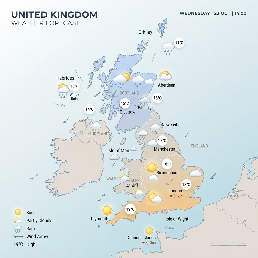
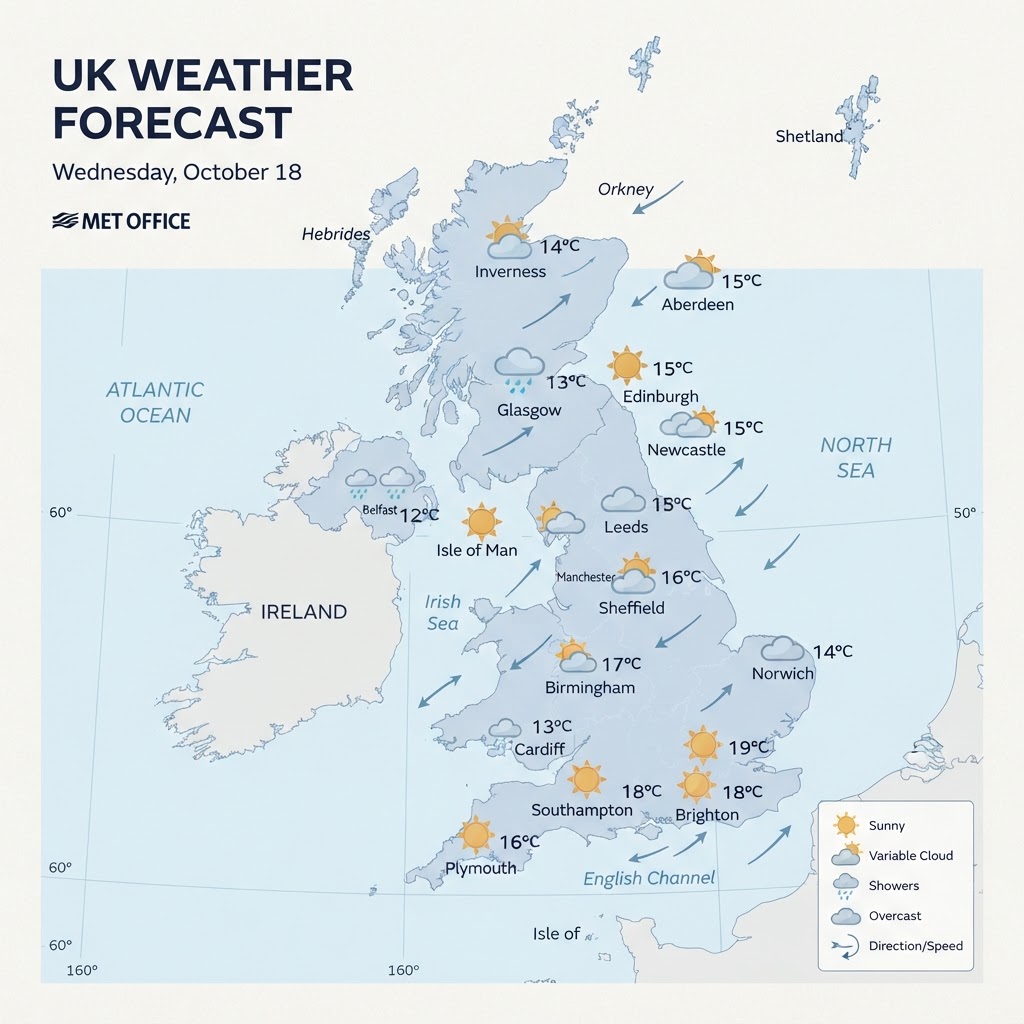
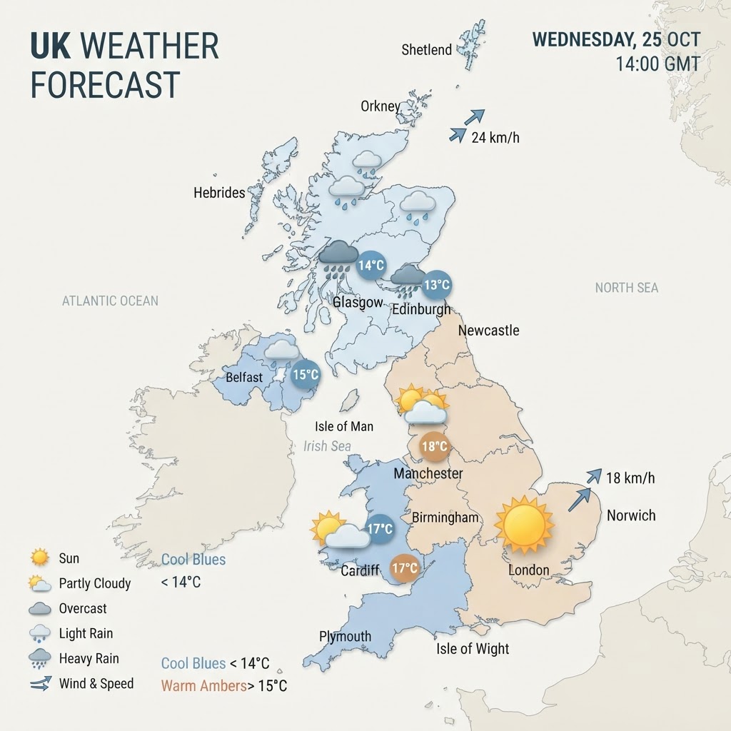
A frontal band of blustery morning rain will sweep southeast across England and Wales today, clearing into a remarkably mild and brighter afternoon with highs peaking near 20°C to 21°C. Meanwhile, northern and western areas, particularly Scotland and Northern Ireland, will experience cooler conditions with blustery showers feeding in behind the clearance. The unsettled, changeable pattern looks set to continue over the next 48 hours as secondary fronts approach from the Atlantic.

UK-Storm AI Forecaster·13 October 2026, 05:03

Overview: An Unsettled, Mild Autumn Front Sweeps the Country

Good morning from the UK-Storm forecast desk. The UK faces a classic active autumn setup today, Tuesday, 13 October 2026, driven by an Atlantic frontal system pushing steadily eastwards. An active band of rain and drizzle will track across England and Wales through the morning hours, accompanied by gusty conditions. However, the system is progressive: by this afternoon, southern and eastern areas will see cloud break apart to reveal some surprisingly warm sunshine, lifting temperatures well above mid-October averages. Further north and west, a cooler maritime airflow takes over behind the boundary, introducing a regime of blustery showers across Scotland and Northern Ireland.

Regional Weather Breakdown

England

England starts under overcast skies, with patchy outbreaks of rain and drizzle steadily tracking eastward through the morning rush hour. By midday and into the early afternoon, conditions will improve dramatically from the west, allowing widespread sunny spells to develop across central, southern, and eastern counties. It will feel exceptionally mild for mid-October, with afternoon maximum temperatures reaching 19°C to 21°C in London and the southeast, and around 16°C to 18°C across the Midlands and northern England. Later in the evening, cloud will begin to thicken again along northwestern coastlines.

Wales

Wales will endure a damp, blustery start to the day as overnight rain clears eastward across the valleys and coastlines by late morning. The afternoon offers a much more pleasant interlude, with drier conditions and bright or sunny spells emerging. Temperatures will reach maximums between 15°C and 18°C, feeling mild during brighter periods, though a fresh southwesterly breeze will linger along exposed headlands.

Scotland

Scotland sits in a cooler, more dynamic airmass today. While far eastern parts may see some initial early morning brightness, scattered heavy showers will rapidly build across western and northern Scotland through the day. In northern areas and across the Highlands, some of these showers may be heavy and accompanied by squally winds. Daytime highs will remain noticeably fresher than in the south, peaking between 12°C and 15°C.

Northern Ireland

Northern Ireland wakes to a fresher, breezy regime following the overnight passage of the main frontal boundary. Sunny intervals will be punctuated by passing blustery showers, most frequent across western counties such as Fermanagh and Tyrone. Top daytime temperatures will hover around 14°C to 16°C in a brisk westerly wind.

Wind & Precipitation Outlook

Wind speeds will be moderate to fresh across most inland areas, generally blowing from the south-west to west at 10 to 20 mph, with gusts reaching 25 to 30 mph as the morning cold front sweeps through. Exposed coasts and high ground in northern Scotland will see stronger gusts touching 35 to 45 mph at times.

Rainfall totals will vary considerably: southern and eastern England will see relatively brief accumulations of 1 to 4 mm during the morning passage. In contrast, western hills in Wales, northern England, and western Scotland can expect heavier totals of 10 to 20 mm where showers merge into longer spells of rain.

Warnings & Notable Weather Events

There are currently no national severe weather warnings issued by the Met Office for today, but motorists are advised to take care during the morning commute across England and Wales due to surface spray and temporarily reduced visibility in heavier bursts of rain. Marine users around the Minch and northern Scottish isles should prepare for rough sea conditions.

48-Hour Outlook: Wednesday & Thursday

The changeable, mobile Atlantic pattern will maintain its grip through midweek:

  • Wednesday, 14 October: A secondary frontal wave approaches, bringing another band of cloud and patchy rain into northwest England, Wales, and Northern Ireland. Southern England will remain mostly dry, bright, and pleasantly mild with highs of 18°C to 20°C.
  • Thursday, 15 October: A persistent band of cloud and patchy rain will drift slowly southeastwards, keeping northern areas breezy and cooler, while southern districts hold onto unseasonably mild temperatures before cooler, fresher air finally filters in toward the weekend.
daily forecastweatherUKAI generated

More in Forecasts

UK Weather Forecast: Mild, Breezy Conditions Across Britain With Heavy Rain Arriving in Northwest – Monday, 12 October 2026
Forecasts

UK Weather Forecast: Mild, Breezy Conditions Across Britain With Heavy Rain Arriving in Northwest – Monday, 12 October 2026

Monday brings an unseasonably mild and breezy autumn day across most of the UK, with temperatures reaching up to 17°C in parts of England. However, cloud will gradually thicken from the west, leading to heavier outbreaks of rain sweeping into Northern Ireland and northwestern Scotland later in the day.

UK-Storm AI Forecaster·12 Oct 2026
UK Weather Forecast: Mild and Breezy Day with Northwest Rain Moving In – Sunday, 11 October 2026
Forecasts

UK Weather Forecast: Mild and Breezy Day with Northwest Rain Moving In – Sunday, 11 October 2026

Sunday brings a largely dry and overcast day for central and eastern areas, while breezy conditions and heavier rain develop across the northwest. Afternoon temperatures remain mild for mid-October, reaching 15°C to 17°C across southern and central Britain before an unsettled front pushes southeast overnight.

UK-Storm AI Forecaster·11 Oct 2026
🌡️ The Heatwave: What’s Happening Across the USA
Forecasts

🌡️ The Heatwave: What’s Happening Across the USA

A large and persistent heat dome has settled over much of the United States and parts of Canada, pushing temperatures into the 40–43°C (104–110°F) range in several World Cup host cities. These conditions are not only uncomfortable—they pose genuine health risks for players, fans, and staff. • Kansas City: “Feels like” temperatures up to 43°C (110°F) during match hours. • Philadelphia: Forecast highs around 39°C (102°F) with heat indices again reaching 43°C (110°F). • Toronto: Humidity pushing perceived temperatures to 40°C (104°F). • Miami, Dallas, Houston: Repeated days of extreme heat risk, with some cities exceeding 40°C. These temperatures are occurring during the tournament’s busiest period, including knockout rounds where intensity is highest. --- 🏟️ Stadium Vulnerability: Which Venues Are Most at Risk? Not all stadiums offer the same protection from the heat. • Dallas, Houston, Atlanta These stadiums have retractable roofs and air‑conditioning, offering significant relief once fans and players are inside. • Toronto, Philadelphia, Kansas City These venues have limited or no roof coverage, leaving tens of thousands of spectators exposed to direct sun for hours. Toronto’s expanded stadium capacity means 43,000 fans will be largely unshaded during matches. Even in cities with indoor stadiums, the walk to the venue can be hazardous. In Dallas, pavement temperatures may reach 50°C (122°F)—hot enough to cause burns or heat stress before fans even reach the gates. --- ⚽ Player Safety: Cooling Breaks, Delays, and Match Disruption The heatwave is already altering how matches are played: • Mandatory hydration breaks are now standard in many fixtures, effectively dividing each half into segments. This disrupts rhythm, tempo, and tactical flow. • Kick-off times are being adjusted, especially in cities facing peak afternoon heat. • Thunderstorms linked to the heatwave have caused delays, including lightning-related suspensions such as the Mexico vs Ecuador match. Climate scientists warn that one in four World Cup matches could be played in very hot conditions, with five matches at risk of reaching heat levels where postponement is recommended. --- 🌍 Why This Heatwave Matters Globally The 2026 World Cup is the largest ever held, with 104 matches across 16 cities in the USA, Mexico, and Canada. Extreme heat in such a widely watched event has global implications: 1. Player Health and Performance High temperatures increase risks of: • Heat exhaustion • Dehydration • Reduced cognitive and physical performance • Higher injury rates The Wet Bulb Globe Temperature (WBGT)—a measure of heat stress—could exceed 26°C in at least 26 matches, a threshold where cooling breaks are essential. 2. Fan Safety Millions of fans are travelling from around the world. Many will be unfamiliar with U.S. summer heat, especially those from cooler climates. Risks include: • Heatstroke during long walks to stadiums • Dehydration from alcohol consumption • Sunburn and UV exposure in open-air venues Cities like Toronto and Philadelphia have already issued public health warnings urging fans to stay hydrated and limit alcohol intake. 3. Tournament Logistics Extreme heat can cause: • Match delays • Changes to training schedules • Reduced fan festival hours (already happening in Philadelphia) • Increased strain on emergency medical services Thunderstorms—another consequence of the unstable, hot atmosphere—add further disruption. --- 🏆 Could the Heatwave Affect the Outcome of the World Cup? In short: yes, potentially in several ways. Tactical Impact Teams accustomed to cooler climates may struggle more in high heat. Slower tempo, reduced pressing, and more substitutions could become common. Fitness and Recovery Heat slows recovery between matches. Squads with deeper benches may gain an advantage. Match Timing If conditions reach dangerous WBGT levels (28°C or higher), matches could be: • Delayed • Rescheduled • In extreme cases, postponed for safety reasons Even a single postponement could disrupt the tournament schedule. Fan Atmosphere Lower attendance at fan festivals, reduced travel comfort, and safety concerns could affect the overall atmosphere and global perception of the event. --- 🔮 Looking Ahead: What Organisers Are Doing FIFA has already taken several steps: • Cooling breaks in every match • Shortened fan festival hours in high-risk cities • Increased misting stations and cooling zones • Medical teams expanded at stadiums • Air-conditioned stadiums used strategically for high-risk fixtures However, climate scientists argue that these measures may not be enough, given the rising frequency of extreme heat events. --- 📝 Final Thoughts for Your Weather Website The 2026 U.S. heatwave is more than a background weather story—it is shaping the World Cup itself. From tactical changes and player safety to fan experience and match scheduling, the extreme temperatures are influencing every aspect of the tournament.

Alan Jones·2 Jul 2026
UK-Storm.co.uk
Home|#UK-Storm
© 2026 UK-Storm.co.uk — All rights reserved.