UK Weekend Weather
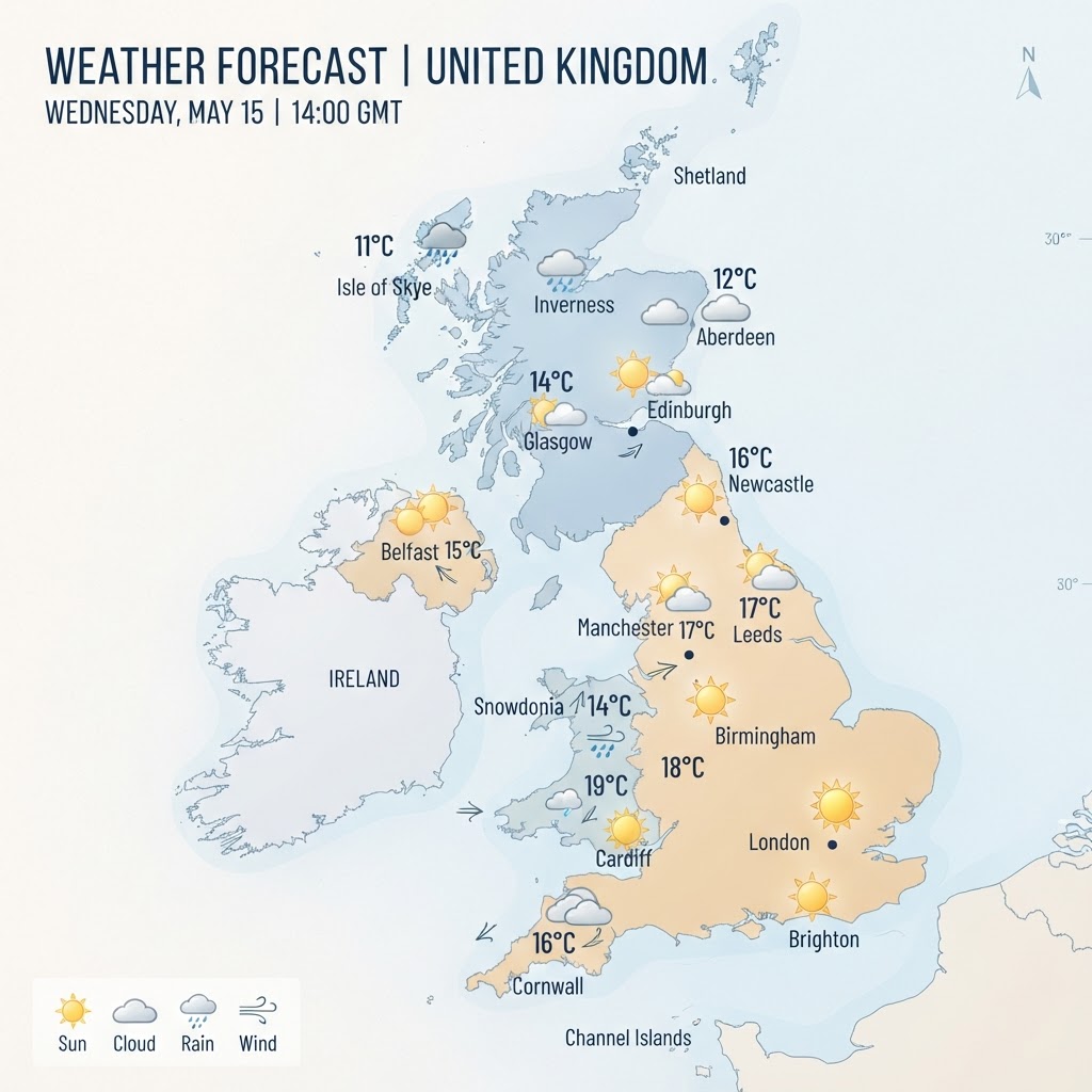
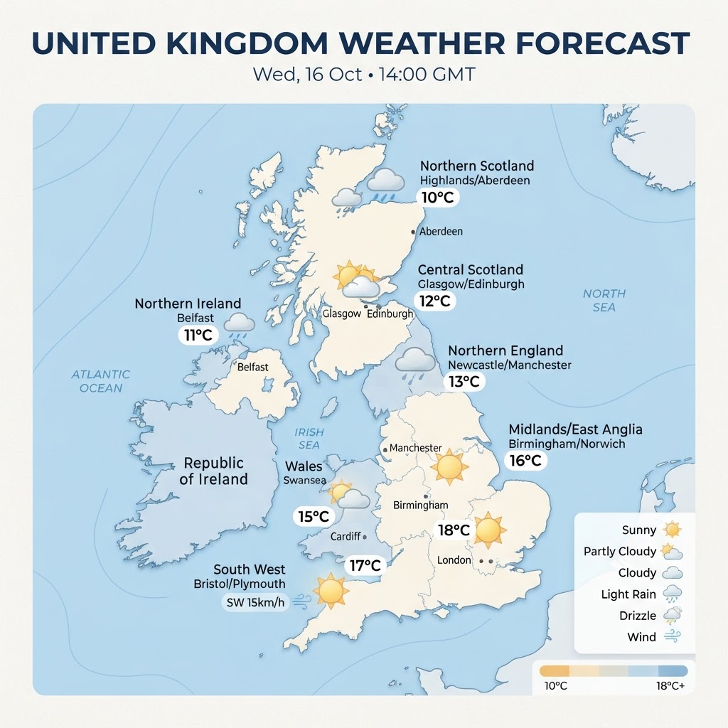
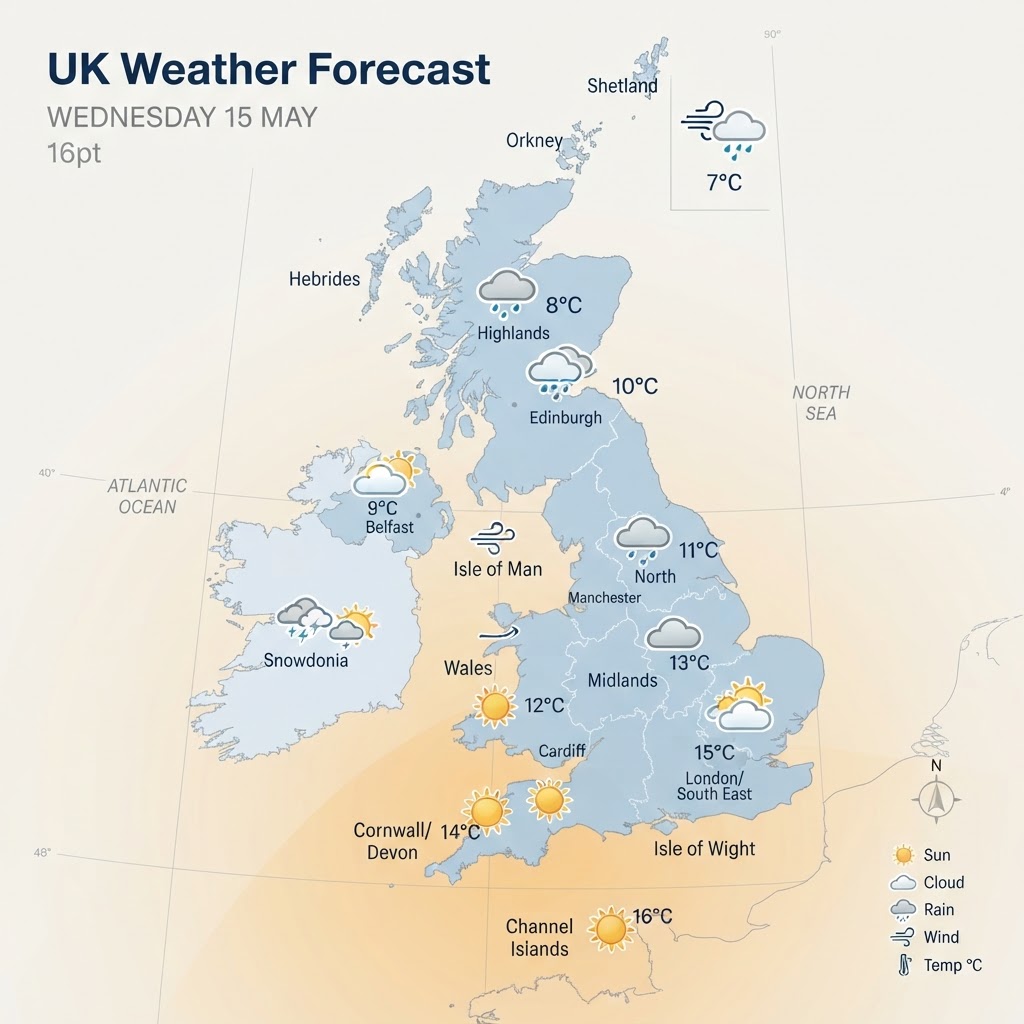
The upcoming weekend across the United Kingdom is shaping up to be a study in contrasts, with sharp differences between north and south, shifting pressure systems, and a mix of chilly mornings, scattered showers, and pockets of surprisingly pleasant sunshine. The overall pattern is being driven by slow‑moving weather fronts and a transition phase in the wider May climate setup, as the UK edges from a cooler, unsettled spell toward what forecasters expect to become a notably warmer period heading into the late‑May bank holiday. A Chilly Start and a Split Across the Country The weekend begins under the influence of lingering cold air, particularly across Scotland, Northern Ireland, and parts of northern England. Northerly winds have been dragging down cooler air masses, leaving temperatures below seasonal averages in many areas. This has already been evident in the days leading up to the weekend, with widespread frost reported in both northern and southern regions early on Friday morning. Saturday morning continues this theme, especially in the north. Scotland and Northern Ireland will start the day feeling distinctly chilly, with temperatures struggling to climb into double digits in some areas. The coldest spots—particularly upland regions—may even see a touch of wintry weather on the highest ground, with forecasters noting a small chance of snow over the Scottish mountains due to the cold air aloft. In contrast, southern parts of the UK will wake to milder conditions. England and Wales, especially the southern half, will see brighter spells developing early in the day. These clearer skies will allow temperatures to rise more quickly, making Saturday feel noticeably warmer than the latter part of the working week for many. Saturday: Sunshine for Some, Showers for Others Saturday is expected to be the drier day of the weekend, though not entirely free of rain. Western areas—particularly parts of Wales and western England—may see light showers during the day. Temperatures here will be mild, reaching around 15–16°C, which is close to seasonal norms for mid‑May. Further north, cloud will thicken as the day progresses, and a zone of rain is likely to develop across northern England. Meanwhile, rising air in central regions will encourage heavy, slow‑moving showers across Wales, the Midlands, and northern England. These showers will be hit‑and‑miss but could be heavy and persistent where they occur. Southern and eastern England, however, are set to enjoy the best of Saturday’s weather. Brighter and drier conditions are expected to hold on for longer, with good spells of sunshine. Temperatures could reach 20–21°C in these areas, feeling pleasantly warm in the sunshine despite breezier conditions near the coast. Saturday Night: Frost Risk Returns As night falls, skies will clear across many northern and western areas. With lighter winds and clearer skies, temperatures will drop sharply, bringing a renewed risk of frost in sheltered parts of Scotland, Northern Ireland, and northern England. This is a reminder that despite the approaching summer, May can still deliver cold nights when conditions align. Elsewhere, cloud and outbreaks of rain will slowly sink southwards as a cold front moves through, setting the stage for a more unsettled Sunday. Sunday: A Wetter, Cooler Day for Many Sunday is expected to be the wetter and cooler of the two weekend days. Heavy downpours are forecast across southern areas of England, with light winds adding to the damp, unsettled feel. Temperatures will be below average in many places, particularly in the south, where highs of 11–12°C are expected—unseasonably cool for mid‑May. Southwest England and western Wales may fare slightly better, with some hope of drier spells, though showers remain possible. Northern areas will continue to feel the influence of cold air, with scattered showers across Scotland and a generally chilly feel persisting. Northern Ireland may see more sunshine than elsewhere, but temperatures will still lag behind southern regions. Regional Summary • Scotland: Coldest conditions, risk of frost, scattered showers, chance of hill snow. • Northern Ireland: Chilly but with some sunny spells; frost risk overnight. • Northern England: Cloudy with showers Saturday; rain band likely; cool throughout. • Wales: Mixed—light showers Saturday, heavy showers possible Sunday; milder in the south. • Midlands: Heavy, slow‑moving showers Saturday; cooler and wetter Sunday. • Southern England: Best sunshine Saturday (up to 21°C); heavy downpours Sunday with temperatures dropping sharply. • East Anglia & Southeast: Brightest and warmest Saturday; unsettled Sunday. Looking Ahead: A Significant Warm‑Up on the Horizon While the weekend itself is mixed and at times chilly, the broader outlook for the UK is far more optimistic. Forecasters are increasingly confident that a warming trend will take hold next week as high pressure begins to build from the south. This shift is expected to bring less cloud, more sunshine, lighter winds, and a steady rise in temperatures. From Thursday onwards, temperatures could rise above average, approaching 20°C across southern areas. By the late‑May bank holiday weekend, some parts of the southeast could reach the mid‑20s, potentially making it one of the warmest spells of the year so far. Weather models, including ECMWF‑based charts, even suggest a four‑day burst of early summer warmth, with highs of 22–24°C across large parts of England and Wales between May 22 and May 25. Scotland and Northern Ireland are also expected to turn warmer, with temperatures in the mid‑to‑high teens. While this may fall just short of official heatwave criteria, the combination of strong sunshine and unusually high temperatures for late May will make it feel distinctly summer‑like. Conclusion This weekend’s UK weather is a classic May mixture—chilly mornings, scattered showers, pockets of sunshine, and sharp regional contrasts. Saturday offers the best chance of warmth and brightness, especially in the south and east, while Sunday turns cooler and wetter for many. Yet beyond the weekend lies a promising shift: a move toward high pressure, rising temperatures, and the potential for a warm, settled bank holiday period.